
Don’t underestimate Mount Misma!
Yes, you have understood correctly. Mount Misma is the mountain you don’t expect… a bit like Canto Alto and I’ll explain why!
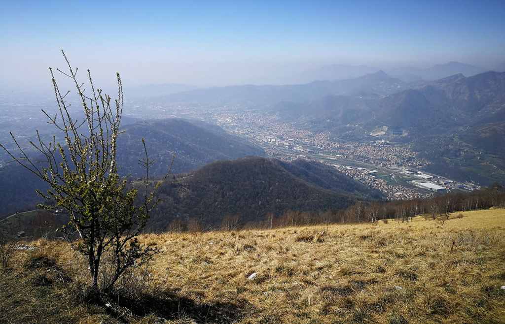
Visible from a large part of the lower central Lombard plain, Mount Misma can be recognised by its 1160m height. It’s also the first mountain we come across when we go up the Seriana Valley.
You might say… well it isn’t even that high… very true but when your itinerary starts from just under 300 metres and the path to the top is only a few kilometres long, you can understand with a simple mathematical calculation that the slopes that await you are not to be underestimated, especially if you leave the house just for “a walk”.
Its paths resemble those of the real Orobie mountains, due to their slope and rocks and for this reason the Mount Misma itineraries are a perfect training ground for all seasons.
Today’s excursion allows you to make a ring route that retraces the southern slope of the mountain, so depending on the season in which you are going, remember the exposure and the sun certainly won’t make it any easier.
It starts from the Cenate Sopra town centre. You can find practical and free parking near the town’s church. Here, you can fill up with fresh water from the water dispenser before you start the 11-kilometre itinerary in the lower Seriana Valley.
“Welcome to Cenate Sopra”
Looking up and looking towards the north you can immediately recognise the day’s goal. The peak of Mount Misma is recognisable by the fact that the last stretch is through meadows without any vegetation.
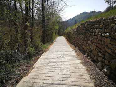
Follow Via Papa Giovanni XXIII and turn left into Via Belotti, the first kilometre and a half is on a paved road that leads you from the centre of the village to Valcalchera. Leave the town and slowly ascend up the leg-warming climb. After the villa that you find on your right you will cross the Sentiero Verde (Green Path) that goes down slightly to the right.
“Go into Nature”
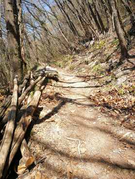
Follow it, cross the Valle Calchera stream (428m above sea level) and enjoy the forest you are now going to walk through. A slight slope will lead you near where the classic path coming from the village of Sant’Ambrogio connects and starts ascending with large boulders that create steps (524m above sea level).
“Ready to go up? Now it gets serious”
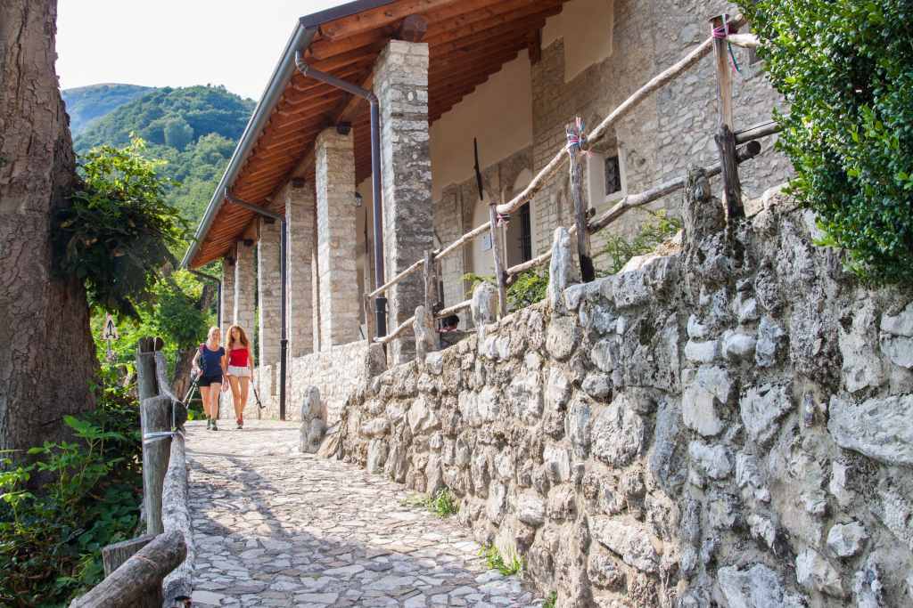
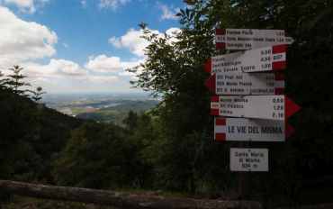
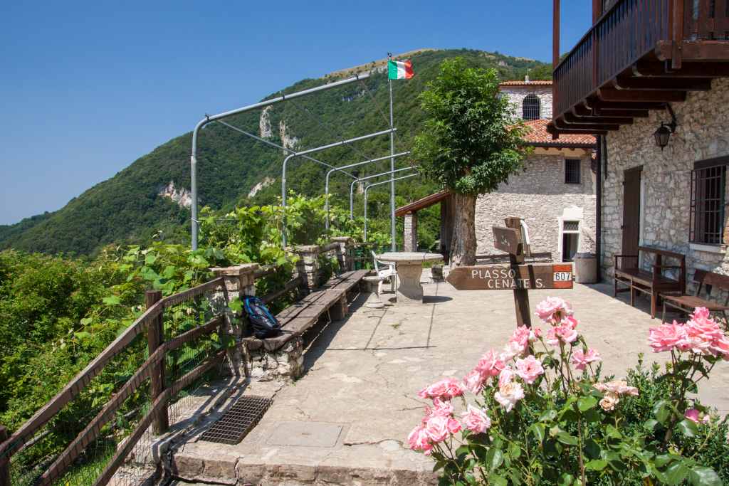
Just under five hundred metres and you will be protected again by vegetation on a path, that with a constant slope, will lead you near the Church of Santa Maria del Misma (822m asl). Take a breath of air and let your gaze be distracted by admiring the plain you have left behind, it’s time to go up again.
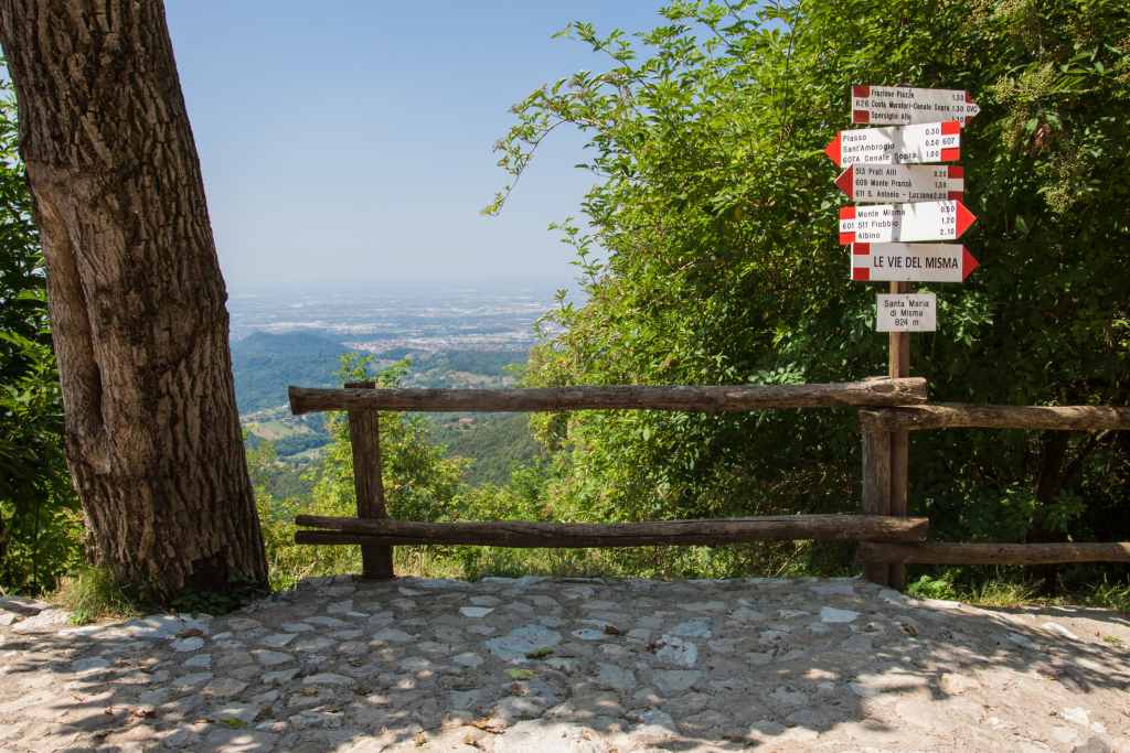
Following the trail CAI 511 you arrive at the Misma pass which now allows you to admire the view of the Orobie mountains and Seriana Valley that opens up in front of you. Turn left, go past the house you find on your path and enter the woods again, taking great care to take the trail CAI 601 that leads to the Misma summit (930m).
“Just before the pass, ready for the Panorama?”
Still a little over a kilometre of woods, stones and big steps before arriving at the pre-summit that will open in front of you and you will find yourself in the meadow that you could see from the parking lot at the departure point. A last effort before reaching the summit’s cross that dominates entrance to the Seriana Valley.
From this point, a 360-degree view opens up, allowing you to admire the city of Bergamo, the lower Bergamo plain and the magnificent setting of the Orobie pre-Alps.
“Gazing towards the beginning of the Seriana Valley”
The descent retraces the last stretch for the first 300 metres. Keep to the right near a large stone man and then descend towards Pradalunga following the path CAI 539. As soon as you leave the meadow you immediately return to the woods. Here the path is characterised by a few hundred meters of steep sections before reaching Cà de la Ert (978m). From here, down again on a technical stretch until you reach the Ruculù (785m), where various paths join together.
“Ol Ruculù”
Our trip now turns left, taking path CAI 513 which, in less than three kilometres, on a slight slope, leads us back to the Church of Santa Maria di Misma. Descend towards the village of Cenate Sopra retracing a little-known and not often frequented path that runs along the entire Calchera stream that starts near the church.
A technical descent where, with due care, you reach an altitude of 485 metres in just a few minutes nearby an agritourism. Take the cemented road which then becomes paved again and arrive again in the inhabited centre of Cenate Sopra where our excursion ends.
“The Calchera stream is thirstier than me”
As anticipated, the South of Mount Misma itinerary, despite being just over 10km long, allows you to test your physical fitness and test your legs and breath throughout the ascent that gives you few breaks.
Ideal in all seasons, paying attention in case of rain and dampness to the many boulders and stone steps that could, especially downhill, play tricks.
Have fun and if you have already walked these paths let me know what you think in the comments!
Post a comment